
Open House Map
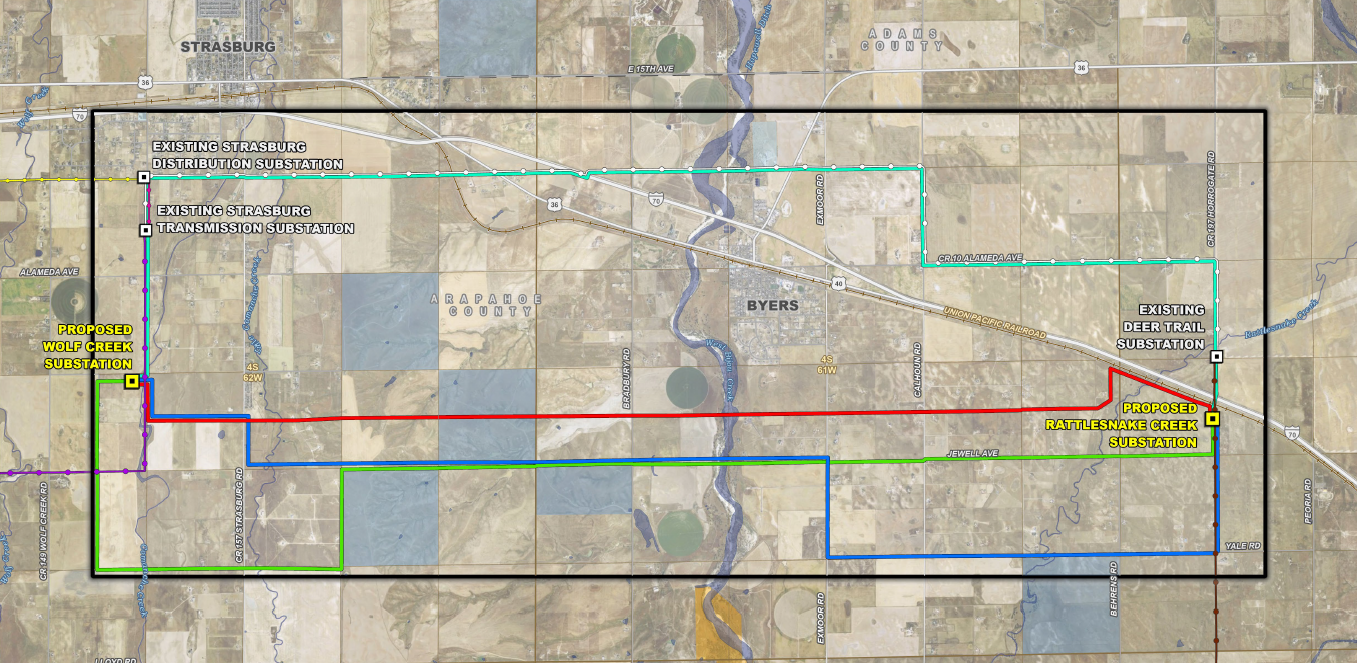
Map Legend — Preliminary Route Alternatives
Project Components
- Existing Substation
- Proposed Substation
- Study Area
Preliminary Route Alternatives
- Red
- Blue
- Green
- Cyan
Existing CORE Transmission Lines
- Strasburg Transmission – Deer Trail
- Deer Trail – Lowland
- Smoky Hill – Strasburg Transmission
- Strasburg Transmission – Strasburg Distribution
- Strasburg Distribution – Bennett
Surface Management
- State of Colorado
- Local Government
- Private Conservation
- County Boundary
- Township/Range Boundary
- Section Boundary
In areas where route alternatives follow identical paths, the lines displayed in this map have been offset from the proposed centerline to maintain visibility.
Preliminary Route Alternatives
CORE Electric Cooperative
Eastern Plains Reliability Upgrade
Arapahoe County, Colorado
Scale: 1:54,000 | Date: 4/7/2026
Data Sources: Burns & McDonnell, CORE, BLM, CDOT, CNHP, Esri, USGS